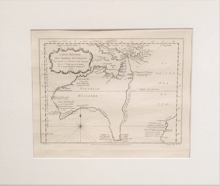
Carte Reduite des Terres Australes
Canberra: Australian Institute of Cartographers, (1753) - 1985. Limited edition, No.29 of 250, engraved map, 200mm x 276mm, with the blind-stamp of the Australian Institute of Cartographers. Near fine condition
Chart reproduced from a copy in the Tooley Collection, National Library of Australia. Shows Australia pre-Cook, based on Dutch discoveries. Continent titled 'Nouvelle Hollande,' Gulf of Carpenteria connected with New Guinea and Tasmania and the mainland. Hypothetical eastern and southern coastlines uncharted. Only the southern coastline of Tasmania charted. Partial outline of the Western coast of New Zealand. Text in French. One of the few eighteenth century maps which focused on Australia. Representative of the French theoretical cartographers of the eighteenth century. Bellin includes notes which indicate the possibility of New Zealand being part of a larger southern landmass. The original was first issued in Antoine François Prevost's 'Historie General des Voyages' , 1746-1759. Item #99757
Price (AUD):
$495.00
Other currencies